I have never done this hike and not lost the trail, and it generally takes me quite some bushwhacking and shin-bruising to find the trail again. This time, the top of the ridge line was still covered with snow. As the snow got deeper to knee-depth, we could proceed only by following a 'trail' (we'd already lost the official trail at that point) that had recently been broken by some stalwart fellow walking in the opposite direction as we. We placed our steps in his, until we got to the top. However, as we proceeded to the traversal portion of the hike, our trail breaker's origins disappeared! His footprints literally appeared out of nowhere, as if he spontaneously materialized out of thin air, and then headed down the ridge! Anyway, M and I started the traversal section of the trail, determined to break our own trail, but as the snow depth increased from ankle, to knee, to waist, we decided, screw this! And headed back the way we came. At least we made it to the top, to enjoy the truly stunning view!
The trail head starts at the Chena River:

There is still ice on the creek:

Partway up the ridge, this is the view back:

Almost *whoof* to the top:

The track we're walking in:

The trail plateaus several times on the ascent:

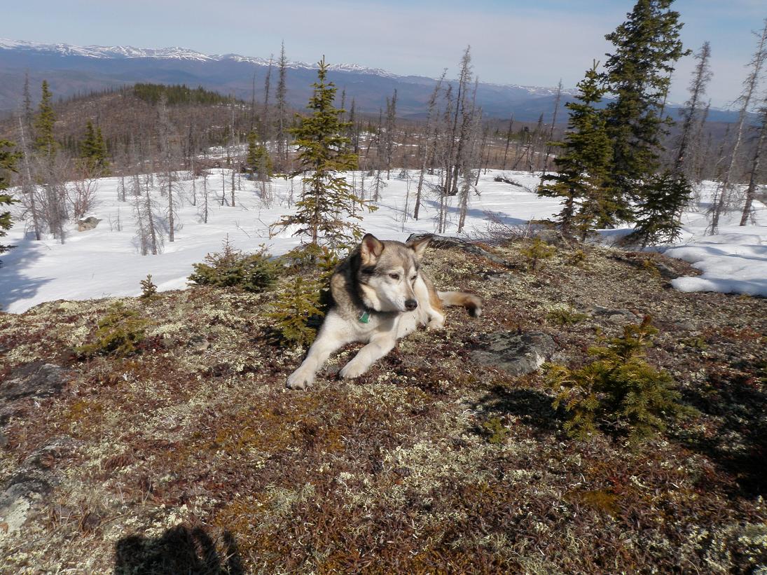
Linden taking a breather:

And Autumn:
Autumn is the best trail rester ever. She can pass out and actually take a nap in two minutes!
Still slogging up:

Finally, we reach the first tor:

The tors are popular with rock climbers, but a 15-mile hike doesn't leave much time to climb, so I'm thinking they camp near the tors.

More tors:

They are picturesque, no?

Especially from a distance:

Finally at the saddle point! This is the view to the south. It was absolutely stunning. This is called the Plain of Monuments, and there are more tors, for those climbers who just can't get enough tors.

We could even see the Alaska Range faintly in the distance:

M appreciating the view:

The dowgs lounging by a trail marker:

I love this shot. I think I need to submit it to Backpacker magazine.
I used a tor as a tripod and tried to get a group photo, but unfortunately, we are backlit!

M photographing a marmot:

Said marmot:

Some of the tors look precariously built:

But according to geologists, they weren't exactly built. They were eroded. Like the sculptures of Rodin, who said, "I choose a block of marble and chop off whatever I don't need."
My first wildflower siting of the season!

Scale of flower:

Later that day, I found fresh grass in my yard, and promptly cut some for Milliebun.
A perfect crater eroded in the tor:

My attempt at postcardism:

The girls lounging around during breaktime, as usual:

Another attempt at a postcard shot:

"Wish you were here! You'd just have to drive 40 miles down Chena Hot Springs Road and hike 6 miles with an elevation gain of 2500 feet with no switchbacks!"
Last view of the first tor as we head back, having given up on the snow-bound trail:

Two rock cairns, which mark the trail above tree line. Can you see them?

Here, I labeled them for you.

Any questions as to why I always lose the trail up here?
Aaaaand here are the famous Granite Tors bushwhacking bruises:
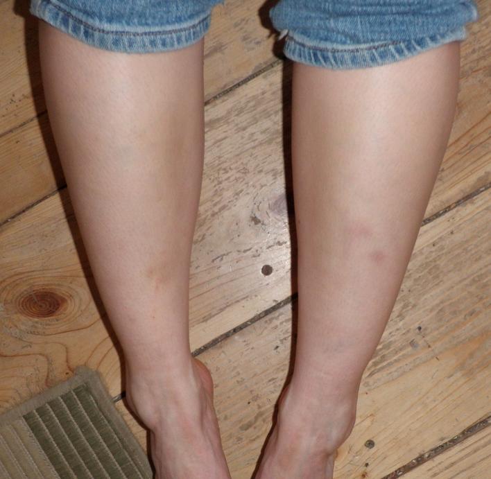
Dead sexy, huh? But I did better this time, thanks to the direction-finding skills of M. Here is a photo from the first time I did this trail:

But even then, it was worth it. Here is a photo from that day:

Gorgeous, no?
4 comments:
Granite Tors is one of the few trails I'll carry a GPS turned on (as opposed to only carrying a map and compass). I've hiked it a half dozen times and I still lose the trail each time. XD I guess that's why they have to rescue a few lost hikers each year there, since it burnt...
Talk about retirement (for your sled dogs)! I still don't understand why you don't have your dogs carry their own water. Didn't I give you a dog backpack?
The dogs don't need any more water than I carry for myself at this time of year--the snow is still melting, and there is standing water nearly always accessible!
OMG MARMOT!
Post a Comment